The South China Sea holds substantial mineral deposits, oil and gas reserves, and serves as a crucial shipping route, making it a significant geopolitical hotspot. China has been engaged in a prolonged contest with neighboring countries over competing claims of sovereignty, with much at stake.
To assert de facto control, China has employed a unique naval force called the People’s Armed Forces Maritime Militia (PAFMM), comprising hundreds of Chinese fishing boats that gather in large groups as a display of force. Monitoring China’s maritime militia is a challenging task due to the sheer number and size of the involved boats. China possesses the world’s largest fishing fleet, consisting of smaller vessels compared to commercial and military ships. Additionally, the South China Sea is often cloud-covered, making frequent optical collections difficult.
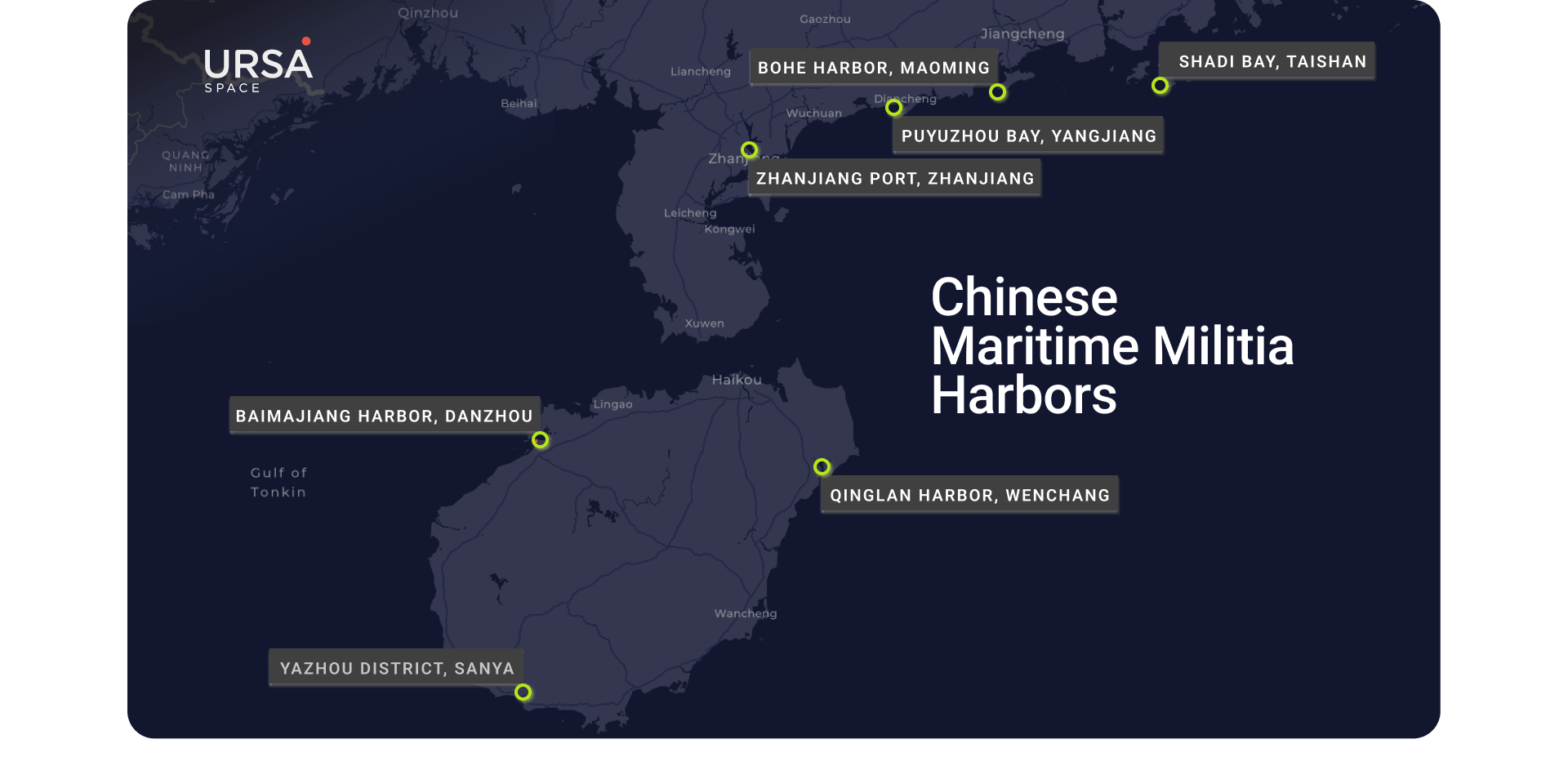
Ursa Space provides an automated, all-weather maritime militia monitoring service using a combination of 35 state-of-the-art synthetic aperture radar (SAR) satellites and Automatic Identification System (AIS) data. By seamlessly integrating SAR and AIS into a single workflow, Ursa can identify fishing vessels in specific harbors and quickly detect changes in their numbers, potentially indicating strategic deployments. Stay ahead of critical maritime activities with our groundbreaking solution that revolutionizes monitoring and response capabilities.
Historically, the PAFMM originated shortly after the Chinese Civil War in the 1940s and initially operated in coastal waters near mainland China. However, since the 1970s, it has been deployed with increasing aggression in more distant areas. For instance, during the Battle of the Paracel Islands in 1974, the PAFMM provided logistical support to the Chinese military, resulting in the seizure of the islands from South Vietnam. China has continued to employ this strategy to seize territory on various reefs and islands in the South China Sea, with the militia playing a crucial role in expanding China’s de facto territory in the region.
The advantage of using SAR technology is its continuous coverage, regardless of weather conditions or darkness. Unlike optical imagery, SAR remains reliable over the South China Sea, which experiences cloud cover for a significant part of the year. SAR can effectively detect fishing vessels due to the strong radar return from their steel hulls. Ursa utilizes SAR to provide an automated and scalable monitoring service tailored for these vessels.
AIS data confirms that fishing vessels frequently travel between fishing harbors and hotspots in the South China Sea. However, AIS data can be unreliable as ship captains can turn off or falsify their AIS transponder. Furthermore, fishing boats often carry Class B transponders, which provide spottier coverage compared to the stronger Class A transponders used by larger vessels.
Ursa’s monitoring service based on SAR involves tracking identified harbors. Significant decreases in the number of boats present can indicate their deployment to the South China Sea for maritime militia duties. This approach utilizes high-resolution SAR imagery from Umbra, a leading provider of advanced space radar technology, to automatically detect even small vessels. Proprietary algorithms are employed to detect individual vessels, measure their length and width, determine their position and bearing, and cross-correlate this information with AIS data to identify “dark” vessels that are not broadcasting AIS signals. This SAR-based solution provides comprehensive coverage, detecting fishing boats that may not appear in AIS-only data services and functioning regardless of weather or ambient light conditions that limit optical imagery.
The scalability of this approach allows for monitoring multiple harbors, and historical data reveals patterns of life that signal potential ship deployments. While lower-resolution SAR imagery may not enable individual ship counting, trends can still be captured through an index created by analyzing the amount of SAR energy in each pixel. Drops in the index suggest significant ship deployments, even without precise ship counts.
Sentinel-1A imagery, provided by the European Space Agency, offers a free and open-source option for SAR-based monitoring. However, its average revisit rate of 12 days in Asia may be less suitable for time-sensitive insights and better suited for long-term trend analysis.
In conclusion, Ursa Space offers automated SAR-based solutions for monitoring the maritime militia challenge in the South China Sea. This service caters to the needs of professionals in security and commercial sectors, providing valuable insights and enhancing situational awareness.