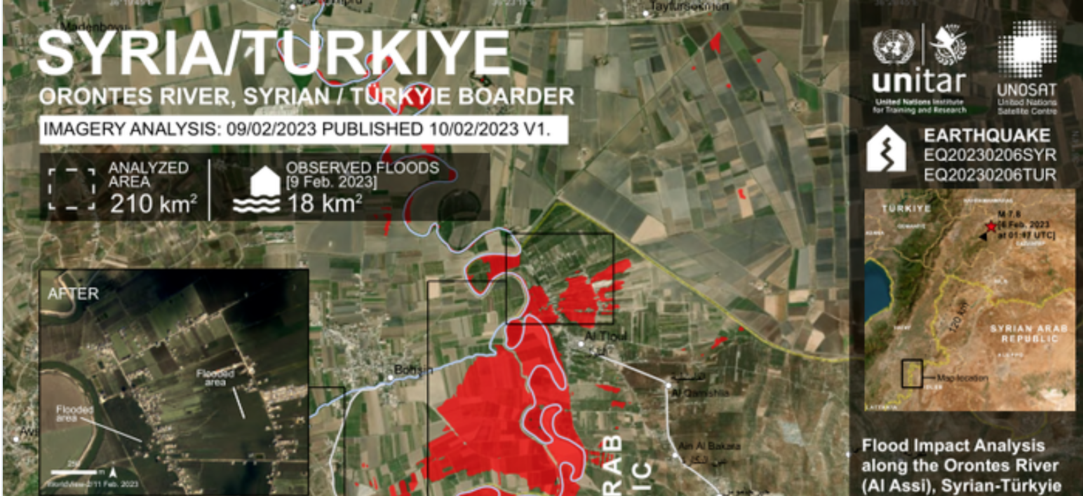
This map illustrates satellite-detected water along the Orontes (Al Assi) River on the Syria-Türkyie border close to the Al Tloul and Jakara towns from a Sentinel-2 imagery acquired on 9 February 2023, and from a Worldview-2 imagery acquired on the 13 February 2023. Within the analyzed area of 210 km2 about 18 km2 appears to be flooded. The floods may have been likely triggered by the opening of dams and the damage induced to certain water infrastructures along the river by the tremors. This is a preliminary analysis and has not yet been validated in the field. Please send ground feedback to United Nations Satellite Centre (UNOSAT).

