In the wake of Japan’s recent natural disasters, the U.S. Space Force has enlisted the expertise of Ursa Space Systems to provide vital analytics to the United States Indo-Pacific Command (USINDOPACOM). The Ithaca, NY-based satellite insights leader completed a task order from the Space Systems Command (SSC), delivering critical data to support disaster response efforts.
Disaster Strikes Ishikawa Prefecture
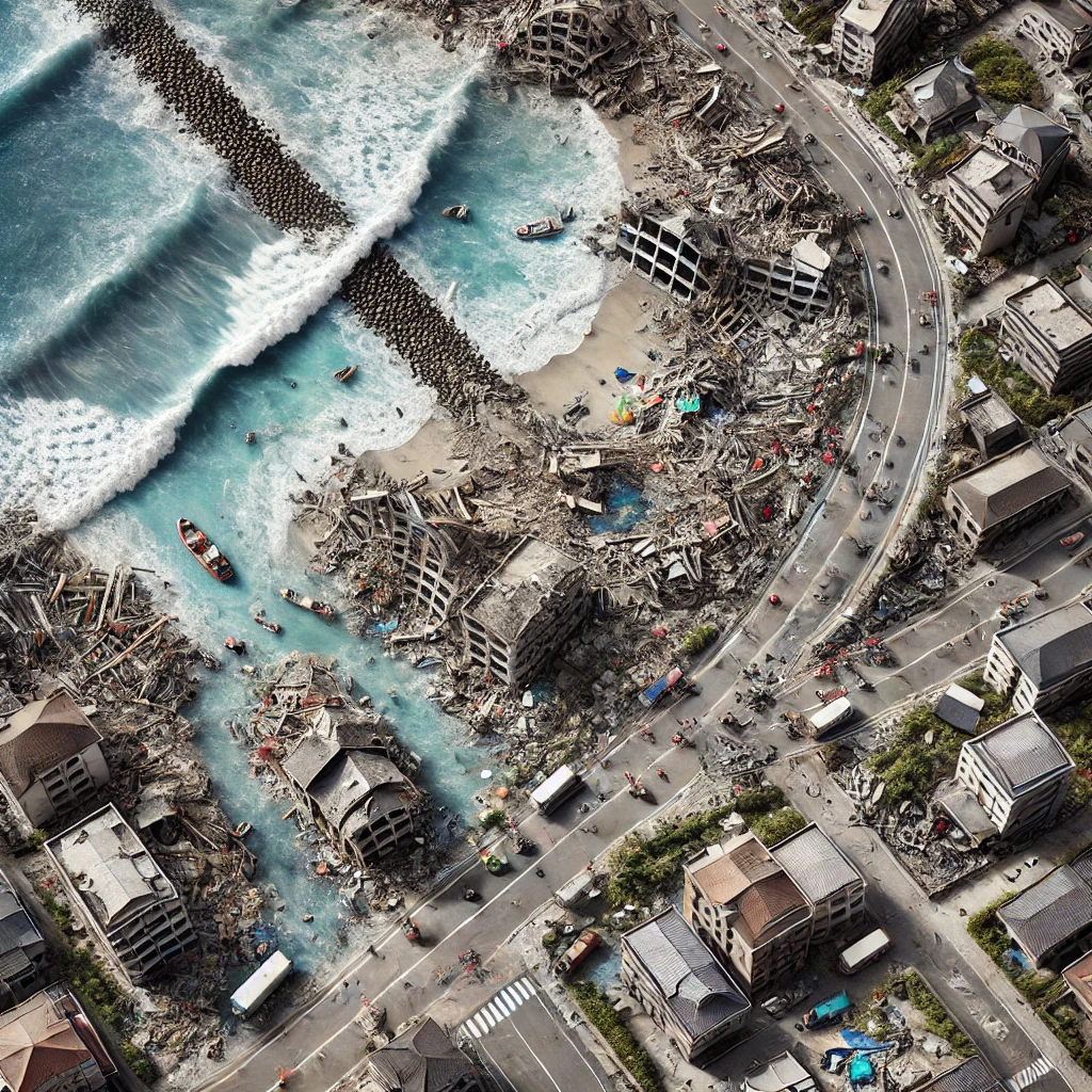
On January 1, 2024, a devastating 7.6 magnitude earthquake rocked Japan’s Ishikawa Prefecture, with the Noto Peninsula bearing the brunt of the impact. This disaster resulted in extensive damage to buildings, triggered fires, and set off tsunami alerts. Just two days later, on January 3, major tsunamis further ravaged Suzu City and its surrounding areas. The calamity claimed the lives of at least 57 people and caused widespread destruction, with ongoing aftershocks exacerbating the situation.
Urgent Task Order for Situational Awareness
In response to the crisis, the Space Force Component (SPACEFORINDOPAC) issued an urgent task order to Ursa Space. The company’s mission was to provide real-time situational awareness to first responders and aid in the planning of relief operations. Ursa Space utilized its extensive capabilities in commercial space remote sensing to produce Operational Planning Products (OPPs). These products, derived from various data sources including EO (electro-optical), SAR (synthetic-aperture radar), and RF (radio frequency), offered comprehensive damage assessments and visual analytics.
SAR Imagery: A Game-Changer
Ursa Space’s proficiency with SAR imagery proved crucial due to persistent cloud cover over the affected regions. Unlike optical imaging, SAR can penetrate clouds and provide clear, actionable data day or night. This capability allowed Ursa Space to identify and assess damaged infrastructure, blocked roads, ground shifts, derelict vessels, flooded zones, and concentrations of displaced individuals. The rapid analysis facilitated by SAR imagery and automated analytics enabled Ursa Space’s analysts to focus on more detailed assessments, enhancing the overall effectiveness of the disaster response.
Comprehensive Data and Rapid Response
Leveraging its vast virtual constellation of commercial space remote sensing vendors, Ursa Space orchestrated short-notice imagery collection and data fusion. The company’s platform, renowned for its scalability and advanced analytics, provided critical insights at unprecedented speed. Ursa Space’s archive catalog, which now exceeds 48 million data records, and its partnerships with 23 trusted satellite imagery providers, ensured that USINDOPACOM had access to the most accurate and timely information available.
Supporting Relief Efforts
The data supplied by Ursa Space has been instrumental in informing and guiding relief efforts. The unclassified OPPs were designed for easy distribution among stakeholders, ensuring that everyone involved in the rescue and recovery operations had a clear understanding of the situation on the ground. This enhanced situational awareness has been vital in coordinating effective and efficient response strategies.
About Ursa Space
Ursa Space is a leader in global satellite insight infrastructure, offering on-demand analytic solutions to business and government decision-makers. Their radar satellite network and data fusion expertise enable real-time detection of physical changes worldwide, providing unparalleled transparency and insight. Ursa Space’s services overcome geographic, political, and weather-related limitations, delivering critical data whenever and wherever it is needed.
About Space Systems Command
The U.S. Space Force Space Systems Command (SSC) is tasked with acquiring, developing, and delivering resilient space capabilities to protect national interests. With a $15 billion annual budget, SSC collaborates with joint forces, industry, government agencies, academic institutions, and allied organizations to stay ahead of emerging threats. Their mission is to ensure the strategic advantage of the United States in space, making the world a better and safer place for future generations.