USGS: HVO scientists captured this aerial view of a much-changed Halema‘uma‘u during their overflight of the summit this afternoon. Explosions and collapse within Halema‘uma‘u have enlarged the crater (foreground) that previously hosted the summit lava lake, and the far rim of Halema‘uma‘u has dropped with continued summit deflation. The parking area for the former Halema‘uma‘u Overlook (closed since early 2008 due to volcanic hazards) can be seen to the left of the crater.

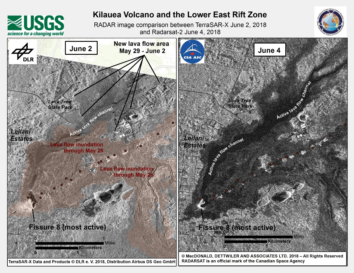
USGS: The International Charter for Space and Major Disasters (https://disasterscharter.org/) is a means for space agencies around the world to help with disaster monitoring by providing satellite data to responders and scientists on the ground. The charter was invoked for recent eruptive activity at Kīlauea, and numerous space agencies are providing satellite imagery that HVO scientists are using to help evaluate eruptive activity. In this example, high-resolution radar data from the German TerraSAR-X satellite acquired on June 2 (left) and from the Canadian RADARSAT-2 satellite on June 4 (right) show the area of the fissure 8 lava flow, which appears as a darkened area in both images. We are grateful to our colleagues and partners at space agencies worldwide for their help in better tracking activity at Kīlauea.
Eruption Digest For June 6: Emergency Housing Plans In Motion

