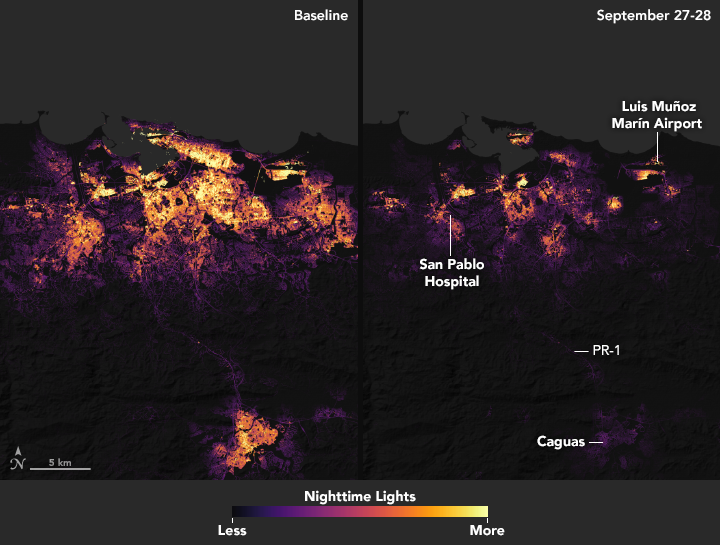
The Visible Infrared Imaging Radiometer Suite (VIIRS) on the Suomi NPP satellite, with its “day-night band,” was used to produce the nighttime data to fine-tune the data from the Suomi NPP satellite and to make it even more useful for responders, additional data was used from satellites such as the Landsat, Sentinel-2, and TerraSAR-X. As well, a team of scientists from NASA’s Goddard Space Flight Center and Marshall Space Flight Center processed and corrected the raw data to filter out stray light from the Moon, fires, airglow, and any other sources that are not electric lights. Their processing techniques also removed as much other atmospheric interference, including dust, haze and thin clouds.
More: http://www.weathernationtv.com/news/scientists-use-satellite-data-assist-puerto-rico-first-responders/

